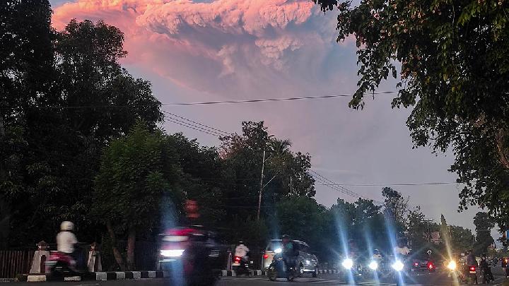
August 21, 2025 | 12:45 pm

The Head of Indonesia's Geological Agency, Muhammad Wafid, stated that Mount Lewotobi Laki-Laki, located in East Flores, East Nusa Tenggara (NTT), still has the potential of experiencing an explosive eruption. The indicator is the increasing non-harmonic tremor earthquakes on Wednesday, August 20, 2025, from 06:00-12:00 WITA (Central Indonesian Time).
"This indicates the presence of fluid flow from the shallow depths towards the surface, indicating that the potential for eruption may still occur in the future," said Wafid in his statement on Wednesday night.
The seismic data of the 1,584-meter-high mountain above sea level (mdpl) in the past two days shows five instances of avalanche earthquakes, eight instances of blast earthquakes, 58 instances of non-harmonic tremor earthquakes, six instances of low-frequency earthquakes, seven instances of natural volcanic earthquakes, two instances of local tectonic earthquakes, six instances of distant tectonic earthquakes, and one continuous tremor earthquake with a dominant amplitude of 3.7 millimeters.
Deformation monitoring using tiltmeter methods in the last 24 hours shows an inflation pattern. This, according to Wafid, indicates that Mount Lewotobi Laki-Laki's body is still under pressure from the inside and has not yet reached stability. Meanwhile, Global Navigation Satellite System (GNSS) data shows a decrease in the vertical component or deflation.
"This indicates that some material has already come out from the inside, but there is still material detained at shallow to deep depths," he said. Therefore, referring to visual and instrumental data, the activity of Mount Lewotobi Laki-Laki is still high, resulting in it being designated at Level IV or Alert status.
The public and tourists are prohibited from entering the Mount Lewotobi area within a 6-kilometer radius from the eruption center. "Stay calm and follow the directions from local authorities," he said.
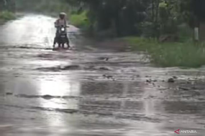
Local residents are also advised to remain wary of the potential for lahar floods, especially during heavy rainfall. Some areas that are passed through by river streams originating from the peak of Mount Lewotobi Laki-Laki, namely Dulipali, Nurabelen, Nobo, Hokeng Jaya, and Nawakote. "Residents affected by volcanic ash rain are advised to use masks or cover their noses and mouths to protect the respiratory system," he said.
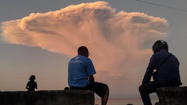
On Monday, August 18, 2025, Mount Lewotobi erupted 11 times. The first eruption occurred around midnight, at 00:38 WITA (Central Indonesian Time), spewing volcanic ash with a column height of eight kilometers from the top of the crater. At 02:21 WITA, the cone-shaped volcano erupted again with an ash column height of 8 kilometers from the top.
In the morning, around 07:23 WITA, Mount Lewotobi erupted again with an ash column height of 3.5 kilometers. The eruption continued at 08:14 WITA, recorded on the seismograph with a maximum amplitude of 29.6 millimeters and a duration of 2 minutes 59 seconds. 20 minutes later, another eruption occurred with a volcanic ash plume reaching four kilometers in height.
At 08:57 WITA, Mount Lewotobi Laki-Laki erupted again, spewing volcanic ash with a height of 3.5 kilometers from the top of the crater. Seismogram recordings show the maximum amplitude of the eruption was 29.6 millimeters with a duration of about 2 minutes 35 seconds. An eruption occurred again at 09:11 WITA, with an ash column height reaching four kilometers from the top of the crater and a maximum amplitude of 44 millimeters in 167 seconds.
After a few hours of calm, Mount Lewotobi Laki-Laki erupted four more times, at 16:22 WITA, 16:51 WITA, 17:12 WITA, and 20:08 WITA. The highest volcanic ash column ejected by Mount Lewotobi Laki-Laki in those eruptions was six kilometers from the top of the crater.
Editor's Choice: Mount Lewotobi Laki-Laki Erupts, Ash Column Reaches 8 Kilometers High
Click here to get the latest news updates from Tempo on Google News
Mount Lewotobi Laki-Laki Erupts, Ash Column Reaches 8 Kilometers High
2 hari lalu
The Geological Agency still sets the status of Mount Lewotobi Laki-Laki in East Flores at Level IV or Caution, the highest level of volcano activity.
Mount Marapi Erupts, Spews Volcanic Ash 1,600 Meters High
9 hari lalu

Mount Marapi in West Sumatra erupted again on Monday morning, August 12, 2025, precisely at 08:39 a.m. Western Indonesia Time (WIB).
Mount Merapi Erupted Lava 110 Times in a Week, Tourists Warned to Stay Alert
9 hari lalu
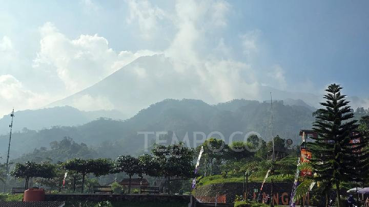
Mount Merapi in Central Java, Indonesia, is currently still on alert status or Level III due to the volcanic activity.
Mount Dukono and Mount Ile Lewotolok in Indonesia Erupted Today
11 hari lalu
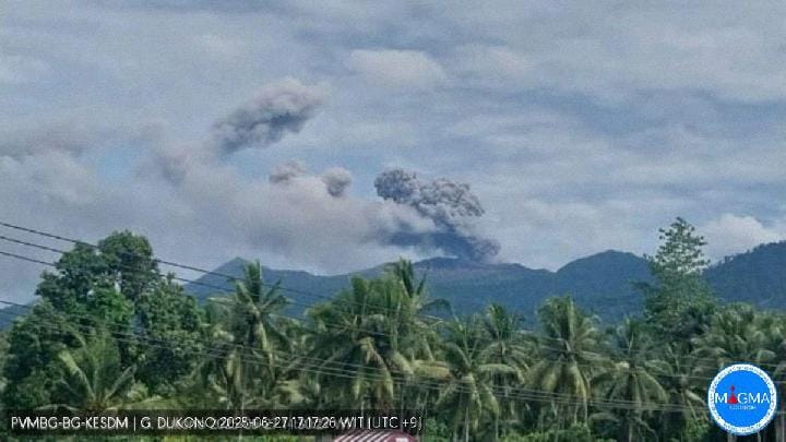
Mount Dukono, located in the northern part of Halmahera Island, North Maluku, Indonesia erupted on Sunday, August 10, 2025.
Mount Lewotobi Laki-laki Erupts Again; Cold Lava Alert Issued
12 hari lalu

Mount Lewotobi Laki-laki, which stands at 1,548 meters above sea level (masl), remains at Alert status, or Level IV, the highest alert status.
Indonesia's Mount Lewotobi Spews 10 Km High Volcanic Ash in Latest Eruption
19 hari lalu
Mount Lewotobi Laki-Laki erupted again on Friday, August 1, 2025, emitting a 10-kilometer ash cloud.
Mount Lewotobi Lava Flood Hits 3 Villages in East Flores
22 hari lalu
A cold lava flood from a river originating from Mount Lewotobi Laki-laki have hit the villages of Hokeng Jaya, Dulipali, and Nurabelen in East Flores.
Geological Agency Warns of Mount Lewotobi's Explosive Eruption Due to Gas Blockage
26 hari lalu
The Geological Agency has maintained the alert status for Mount Lewotobi Laki-laki in East Flores, East Nusa Tenggara (NTT).
Mount Lewotobi Laki-laki Erupts: Ash Plume Reaches 4 Kilometers High
40 hari lalu

The Geological Agency noted that Mount Lewotobi Laki-laki still has a high potential for an explosive eruption.
Save the Children Indonesia Readies Clean Water for Mount Lewotobi Displaced
40 hari lalu

Besides fulfilling children's rights to access clean water and sanitation, Save the Children Indonesia along with CIS Timor also provides psychosocial support.