November 29, 2025 | 09:11 am
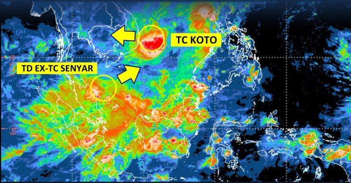
TEMPO.CO, Jakarta - The Meteorology, Climatology, and Geophysics Agency (BMKG) predicts that the ex-tropical Cyclone Senyar, known as Ex-Tropical Depression (TD), will continue to intensify today, Saturday, November 29, 2025. According to the BMKG analysis as of 7:00 PM WIB (Western Indonesia Time) yesterday, the wind speed of Ex-Cyclone Senyar could reach 35 knots or approximately 65 kilometers per hour. A wind vortex moving northeast toward the South China Sea has the potential to become a Category 1 cyclone.
After its maximum wind speed weakened, the remnants of Cyclone Senyar moved around the South China Sea west of Tarempa. Until last night, its maximum speed was still 30 knots or 55 kilometers per hour. Its minimum air pressure was 1,006 hPa.
With a moderate to high chance of re-intensifying into a cyclone, Ex-Cyclone Senyar is expected to directly and indirectly affect the weather and sea waves in Indonesia. Heavy to very heavy rain is expected in the Riau Islands and West Kalimantan. Meanwhile, moderate rain is likely in West Sumatra, Jambi, and Riau.
BMKG also predicts strong winds due to Ex-Cyclone Senyar in West Sumatra and the Riau Islands. At sea, this wind phenomenon will cause medium waves, up to 2.5 meters in the Riau waters, Karimun Islands waters, Batam-Bintan-Lingga Islands waters, and waters north of Bangka Island to Belitung. The same prediction applies to the waters of West Kalimantan, the northern part of the Karimata Strait, the Natuna Sea, and the waters of the Anambas Islands.
Editor's Choice: BMKG Forecasts Afternoon Rain in Jakarta
Click here to get the latest news updates from Tempo on Google News
Study Finds New Climate Patterns Could Improve Extreme Weather Predictions
22 jam lalu
Recently discovered anomalous climate conditions increase the likelihood of extreme weather, according to Austrian researchers.
Tropical Cyclone Senyar Weakens, While Koto Persists
1 hari lalu
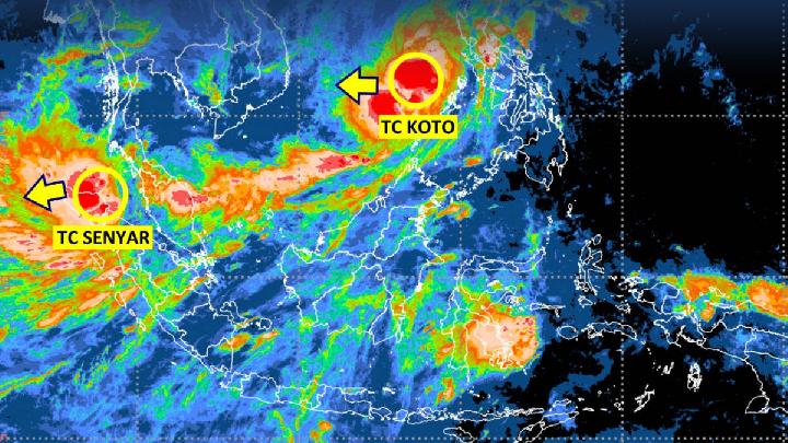
Tropical Cyclone Koto is moving further away from Indonesia but still triggers the potential for extreme rainfall in the Riau Islands.
BMKG: Jakarta Likely to Remain Cloudy Today
1 hari lalu

A light-intensity rain is predicted, but it will only affect a few areas in Jakarta's satellite cities.
Tracking Tropical Cyclone Senyar's Path After Making Landfall in Aceh
2 hari lalu
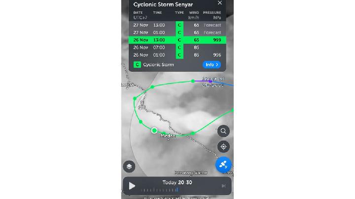
Tropical Cyclone Senyar is predicted to have re-entered the waters of the Malacca Strait, east of Aceh, today on Thursday, November 27, 2025.
Jakarta Remains Cloudy Amid Tropical Cyclones
2 hari lalu

While Tropical Cyclones Senyar and Koto are affecting the northern parts of Indonesia, what about the weather in Jakarta and the surrounding areas?
Extreme Weather Brews as Two Tropical Cyclones Surround Indonesia
2 hari lalu

BMKG detected two tropical cyclones affecting the weather in Indonesia, namely Tropical Cyclone Koto and Tropical Cyclone Senyar.
Today's Top 3 News: Cyclone 95B Behind Malaysia Floods Expected to Make Landfall in Sumatra
2 hari lalu

Here is the list of the top 3 news on Tempo English today.
Two Cyclone Seeds Trigger High Waves and Powerful Winds in the Nias Islands
2 hari lalu

BMKG reminds mariners of the effects of cyclone 95B and 92W winds. The latest high wave early warning is valid from 26-29 November 2025.
BMKG Warns: Tropical Cyclone 95B Could Bring Extreme Weather to Aceh, North Sumatra, West Sumatra and Riau
2 hari lalu
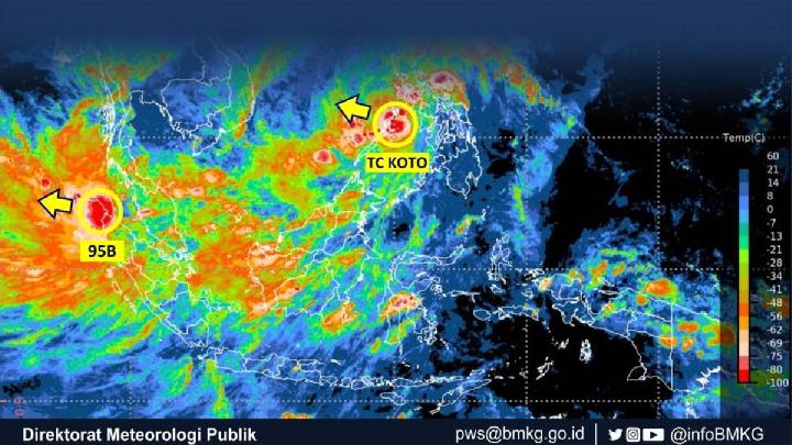
Tropical Cyclone 95B triggers the potential of extreme weather including heavy to extreme rain and strong winds, according to the BMKG.
Cyclone 95B Behind Malaysia Floods Expected to Make Landfall in Sumatra
3 hari lalu

A BRIN researcher said that if Tropical Cyclone 95B does make landfall in Sumatra, the impact of its strong winds will be tremendously destructive.


